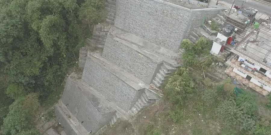
Winnipeg sits squarely in the basin of the former glacial Lake Agassiz, a fact that defines nearly every geotechnical challenge in the city. The thick, compressible lacustrine clays deposited across the Red River Valley create slope stability conditions that demand rigorous analysis long before any excavation begins. Over the decades, riverbank failures along the Assiniboine and Red rivers have reshaped neighborhoods and prompted the province to invest heavily in geotechnical investigations. A proper slope stability analysis in Winnipeg is not a generic exercise—it requires direct knowledge of the local stratigraphy, the high plasticity of the regional clays, and the influence of seasonal groundwater fluctuations. We apply limit equilibrium methods and, when warranted, finite element modeling to quantify the factor of safety for both temporary construction slopes and permanent embankments. This technical rigor protects infrastructure ranging from riverfront properties in the city’s older wards to new suburban developments on gentle valley slopes. For sites with deep soft deposits, understanding the shear strength profile is essential, and we often supplement the analysis with in-situ permeability testing to define pore pressure regimes and triaxial testing to capture the undrained behavior of the Winnipeg clay.
In Winnipeg’s glaciolacustrine clay, a slope stability analysis that ignores seasonal pore pressure change can underestimate failure risk by 40% or more.
Methodology and scope
The geotechnical profile beneath Winnipeg is dominated by up to 20 meters of glaciolacustrine silty clay, often underlain by glacial till over bedrock. This clay is known for its moderate to high plasticity, with liquid limits commonly ranging from 50% to 80%, and a sensitivity that can lead to significant strength reduction when remolded. A slope stability analysis in Winnipeg must contend with these materials at their weakest state—saturated, with pore pressures near hydrostatic after spring melt or heavy autumn rains. We incorporate site-specific data from boreholes and test pits to define critical failure surfaces, evaluating both short-term (undrained) and long-term (drained) conditions per the Canadian Foundation Engineering Manual. The analysis frequently reveals that slopes as gentle as 3:1 can approach marginal factors of safety when groundwater levels are not controlled. Our approach integrates shear vane tests, CPTu data, and laboratory direct shear results to build a reliable geotechnical model. In many cases, the most cost-effective solution involves groundwater management rather than structural reinforcement.
The Red and Assiniboine riverbanks present a dynamic boundary condition. Fluvial erosion at the toe of a slope can remove passive resistance, triggering retrogressive failures that propagate well beyond the riverbank itself. A complete slope stability analysis in Winnipeg includes an assessment of erosion potential and, where applicable, the effects of rapid drawdown. We reference the Manitoba Infrastructure standards and the National Building Code of Canada (NBCC) to ensure compliance with provincial and federal requirements. Our experience on dozens of riverbank projects from St. Vital to Charleswood has shown that early geotechnical input reduces remediation costs by an order of magnitude compared to post-failure emergency works. The analysis is not only about safety margins; it’s about giving developers and municipal engineers the confidence to proceed with construction on challenging terrain.
Local considerations
A slope failure in Winnipeg’s sensitive clays can propagate rapidly, with the initial scarp retreating tens of meters within hours. We’ve seen this on the Assiniboine River, where a modest rotational slide exposed utilities and threatened multi-family housing. The risk multiplies when construction proceeds without a thorough slope stability analysis in Winnipeg. Excavations for basements, underground parking, or utility trenches can unbalance a slope that appeared stable for decades. The factor of safety drops sharply during the spring thaw, when meltwater infiltrates desiccated surface clay and saturates the upper layers. This condition, combined with toe erosion from river currents, creates a classic setup for a compound failure surface. Our team mitigates this risk by installing piezometers early and monitoring pore pressure response through at least one full seasonal cycle before finalizing design recommendations. For permanent slopes, we specify drainage measures—toe drains, trench drains, or relief wells—that lower the phreatic surface and increase the effective stress along the critical failure arc. When the analysis indicates a factor of safety below 1.5 for long-term conditions, structural solutions such as lightweight fill, shear keys, or retaining walls become necessary. The cost of ignoring these risks is not theoretical: Winnipeg has a documented history of riverbank failures, and most could have been anticipated with a competent geotechnical investigation.
Applicable standards
NBCC 2020 (National Building Code of Canada), Canadian Foundation Engineering Manual (CFEM), 4th Edition, CSA A23.3: Design of Concrete Structures, Manitoba Infrastructure Geotechnical Design Standards, ASTM D7181 (Consolidated Drained Triaxial), ASTM D4767 (Consolidated Undrained Triaxial)
Frequently asked questions
What triggers slope instability in Winnipeg’s clay soils?
The primary triggers are seasonal groundwater rise, toe erosion from river currents, and unplanned excavation at the slope base. Winnipeg’s Lake Agassiz clays are sensitive; when saturated, their undrained shear strength can drop significantly. Spring melt and heavy autumn rains are the most critical periods.
How much does a slope stability analysis cost in Winnipeg?
Cost depends on the slope geometry, site access, and the extent of subsurface investigation required. For a typical residential riverbank lot, the analysis ranges from CA$1,520 to CA$3,400. For larger commercial or infrastructure slopes requiring multiple boreholes and instrumentation, costs range from CA$3,800 to CA$5,860.
What is the minimum factor of safety required for slopes in Manitoba?
Per the Canadian Foundation Engineering Manual and Manitoba Infrastructure guidelines, permanent slopes require a minimum factor of safety of 1.5 for long-term drained conditions. Temporary construction slopes may be designed to 1.3, provided the exposure period is short and monitoring is in place.
How long does a slope stability investigation take?
A complete investigation typically spans three to five weeks. This includes site reconnaissance, borehole drilling with sampling, laboratory testing for shear strength and consolidation parameters, and the analytical modeling. If pore pressure monitoring over a seasonal cycle is required, the timeline extends accordingly.