Winnipeg sits on up to 20 meters of glaciolacustrine Lake Agassiz clay. When you open a cut deeper than 3 meters downtown or near the rivers, the shoring system talks to you through cracks, creep, and water seepage. The problem is most contractors wait until the street shows distress before reacting. Our monitoring program installs inclinometers, piezometers, and surface settlement points before the first bucket hits the ground, and we track deformations against the action levels set during design. For deep cuts alongside sensitive brick buildings in the Exchange District, we combine real-time automated total stations with manual crack gauges on adjacent heritage facades. This isn't paperwork, it's the difference between a controlled excavation and a call to the City's building inspector.
Lake Agassiz clay doesn't fail explosively, it creeps. Monitoring catches the creep before the shoring redistributes load where you didn't plan for it.
Frequently asked questions
What are the City of Winnipeg's requirements for excavation monitoring?
The City requires a shoring permit for excavations deeper than 3 meters, and the geotechnical engineer of record must specify a monitoring plan as part of the shoring design submission. For cuts near heritage buildings or within the downtown district, the planning department typically mandates baseline condition surveys of adjacent structures and monthly deflection reports. Vibration monitoring must follow CSA S832 guidelines when rock breaking or pile driving occurs within 50 meters of occupied buildings.
How much does geotechnical excavation monitoring cost in Winnipeg?
For a typical urban excavation project, expect monitoring services to range from CA$1,070 to CA$3,030 depending on duration, number of instruments, and reporting frequency. A 4-week monitoring program with weekly inclinometer readings and manual settlement surveys falls on the lower end. A 12-week program with automated total stations, wireless piezometers, and daily reporting reaches the upper range. Each quote is project-specific and includes instrument installation, calibration, data processing, and a final closure report.
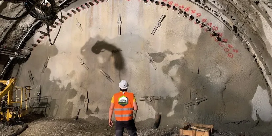
What instruments do you install for a shored excavation in Lake Agassiz clay?
The standard suite includes slope inclinometer casings behind the shoring to track lateral deflection profile, vibrating wire piezometers to measure pore pressure response, and settlement monuments or heave pins at the excavation base. For cuts near sensitive structures, we add automated total station prisms, tiltmeters on the walers, and crack gauges on adjacent foundations. The instrument layout is designed to capture the failure mechanisms specific to Winnipeg's stiff-to-soft clay transition.
How often should excavation monitoring readings be taken?
During active excavation and shoring installation, inclinometers and survey points should be read daily. Once the final grade is reached and the permanent structure begins rising, the frequency drops to weekly. After a major rain event or vibration incident, we run an immediate full reading cycle. Automated systems log continuously and flag exceedances in real time. The City typically expects at least bi-weekly reports for the permit file.