A few years back we reviewed a twelve-story condo excavation on Assiniboine Avenue where the contractor assumed a simple soldier pile wall would hold back 10 meters of cut. Within two weeks of reaching subgrade, the upper lacustrine silty clay started creeping inward, and the adjacent parkade slab developed hairline cracks. The root cause wasn’t poor workmanship — it was a geotechnical model that underestimated the time-dependent strength loss of the stiff clay till when unloaded. At 49.9° north, with seasonal frost penetrating well past 2 meters, the active earth pressures in Winnipeg’s proglacial deposits behave very differently from textbook assumptions once you expose the face through a winter cycle. Our excavation designs start from that reality: measured pore pressures, Lake Agassiz stratigraphy, and staged support sequences that respect the soil’s post-peak sensitivity. Whether the project is a downtown parkade, a combined sewer overflow shaft, or a cut-and-cover tunnel segment, the design has to survive freeze-thaw right along the cut face, not just satisfy a single stability ratio on paper. Often we complement the site investigation with an in-situ permeability test because the interbedded silt lenses within the till control the actual dewatering demand far more than bulk clay permeability numbers suggest.
Winnipeg’s Lake Agassiz clay doesn’t forgive shortcuts: once the fissures open and pore pressures equalize behind the cut, the soil mass behaves like a drained material with zero cohesion — and the shoring has to be designed for it.
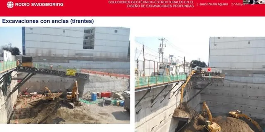
Methodology and scope
The most frequent mistake we see in Winnipeg is designing the shoring for ‘undrained’ conditions and forgetting that the Lake Agassiz clay fissures can open up after a few dry summer weeks, switching the failure mode from intact shear to a drained wedge sliding along a pre-existing slickenside. That oversight has cost developers months of delay and hundreds of thousands in remedial tiebacks. A proper deep excavation design here must consider at least four distinct soil units: the desiccated upper crust, the soft to firm lacustrine clay, the stony till, and the underlying bedrock surface — which on the west side of the city can be limestone, and on the east side, Precambrian granite. Each unit has its own stiffness, its own horizontal stress memory, and its own permeability contrast. We model the staged excavation with finite-element or finite-difference tools, calibrating the constitutive parameters against lab triaxial data from Shelby tube samples, then verify the predictions with inclinometer and piezometer readings during construction. For deep shafts near the Red or Assiniboine rivers, where the water table sits barely 2 meters below grade, the dewatering system and the structural wall have to be designed as a coupled system — not as separate contracts. The NBCC 2015 and CSA A23.3 govern the structural concrete components, while the geotechnical factors of safety follow the recommendations of the Canadian Foundation Engineering Manual.
Local considerations
Winnipeg sits on the floor of glacial Lake Agassiz, and the lacustrine clays that blanket the city can be 15 to 25 meters thick before hitting the underlying till. That clay is overconsolidated, stiff near the surface, and heavily fissured — a combination that makes it notoriously prone to long-term strength relaxation. When you open a deep cut, the horizontal stress relief is immediate, but the pore-pressure equalization takes weeks or months. The risk is that the temporary shoring, designed for short-term undrained strength, becomes under-designed for the drained, softened condition that follows. Adding to the challenge, the Red River valley’s flat topography means there’s almost no natural hydraulic gradient to help dewatering — you’re pumping against a practically flat-lying water table that recharges from the rivers. In the Exchange District and Broadway areas, we’ve measured artesian conditions in the bedrock where old river channels scoured through the till, and those upward gradients can destabilize the base of an excavation if not depressurized before digging. A base heave failure in stiff clay is rare, but when it happens, it happens fast and without much warning.
Applicable standards
NBCC 2015 — National Building Code of Canada (excavation and foundation provisions), CSA A23.3:14 — Design of concrete structures (shoring walers, lagging, cast-in-place walls), ASTM D7181 — Consolidated drained triaxial compression test for soils (strength parameters for FEM), Canadian Foundation Engineering Manual, 4th Ed. — Earth pressure and slope stability guidelines
Frequently asked questions
How much does a geotechnical design for a deep excavation cost in Winnipeg?
For a typical urban excavation between 6 and 15 meters deep, the geotechnical design package — including soil-structure interaction modelling, shoring drawings, dewatering plan, and instrumentation layout — ranges from CA$2,600 to CA$10,500 depending on the number of stages, complexity of the stratigraphy, and whether bedrock depressurization is required. Projects adjacent to heritage buildings or riverbanks fall toward the upper end of that range.
What’s the biggest challenge with Winnipeg’s clay for deep excavations?
The Lake Agassiz clay is fissured and overconsolidated, so it loses strength over time once the cut is open. The undrained strength that holds the wall on day one can drop significantly after a few months of pore-pressure equalization and freeze-thaw cycling. That means the shoring has to be designed for a drained, long-term condition, not just the short-term excavation case.
Do I need a dewatering system for a basement excavation in downtown Winnipeg?
Almost certainly. The water table across much of downtown sits within 2 to 3 meters of the surface, and the flat terrain means there’s no easy way to daylight drainage. Most projects require a combination of deep wells or wellpoints to lower the phreatic surface below the cut, plus depressurization wells if the bedrock aquifer is confined and connected to the river.
What instrumentation do you specify during excavation?
We typically require inclinometers behind the shoring to track lateral deflection with depth, vibrating-wire piezometers to monitor pore-pressure dissipation, and survey prisms on adjacent structures to catch settlement early. For cuts deeper than 12 meters or next to sensitive infrastructure, we add load cells on tiebacks or struts so the actual force can be compared to the design assumption in near real time.